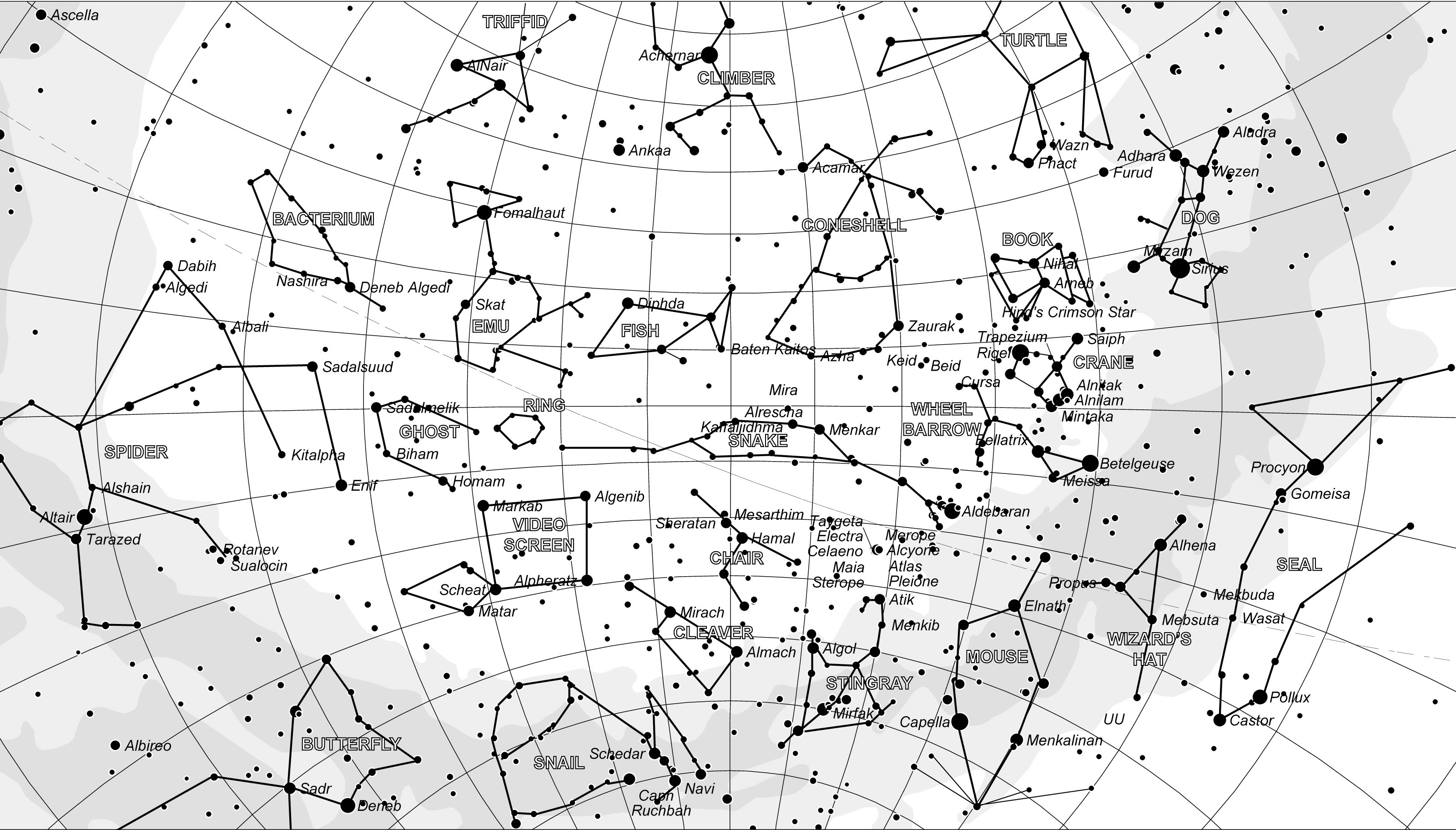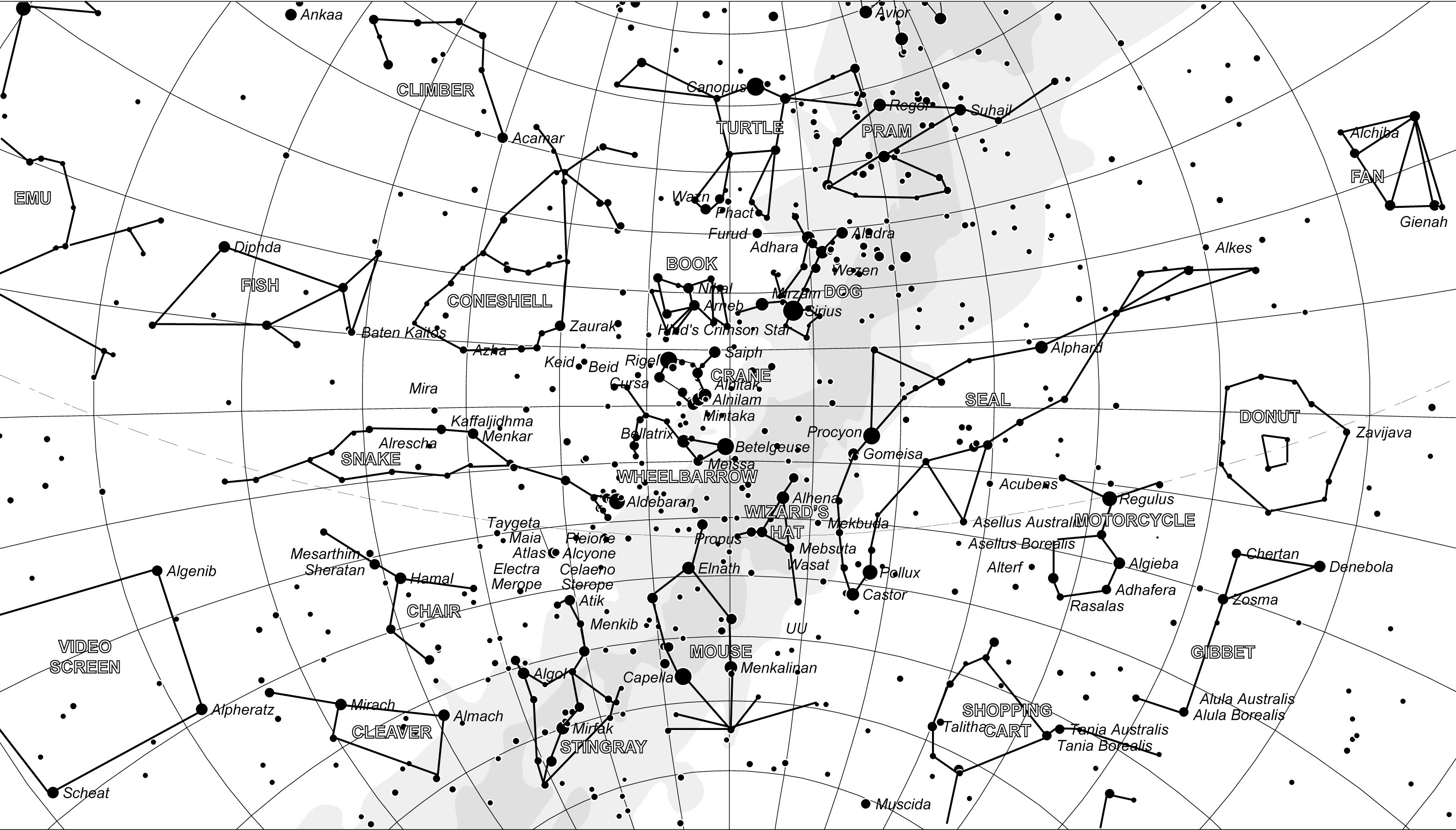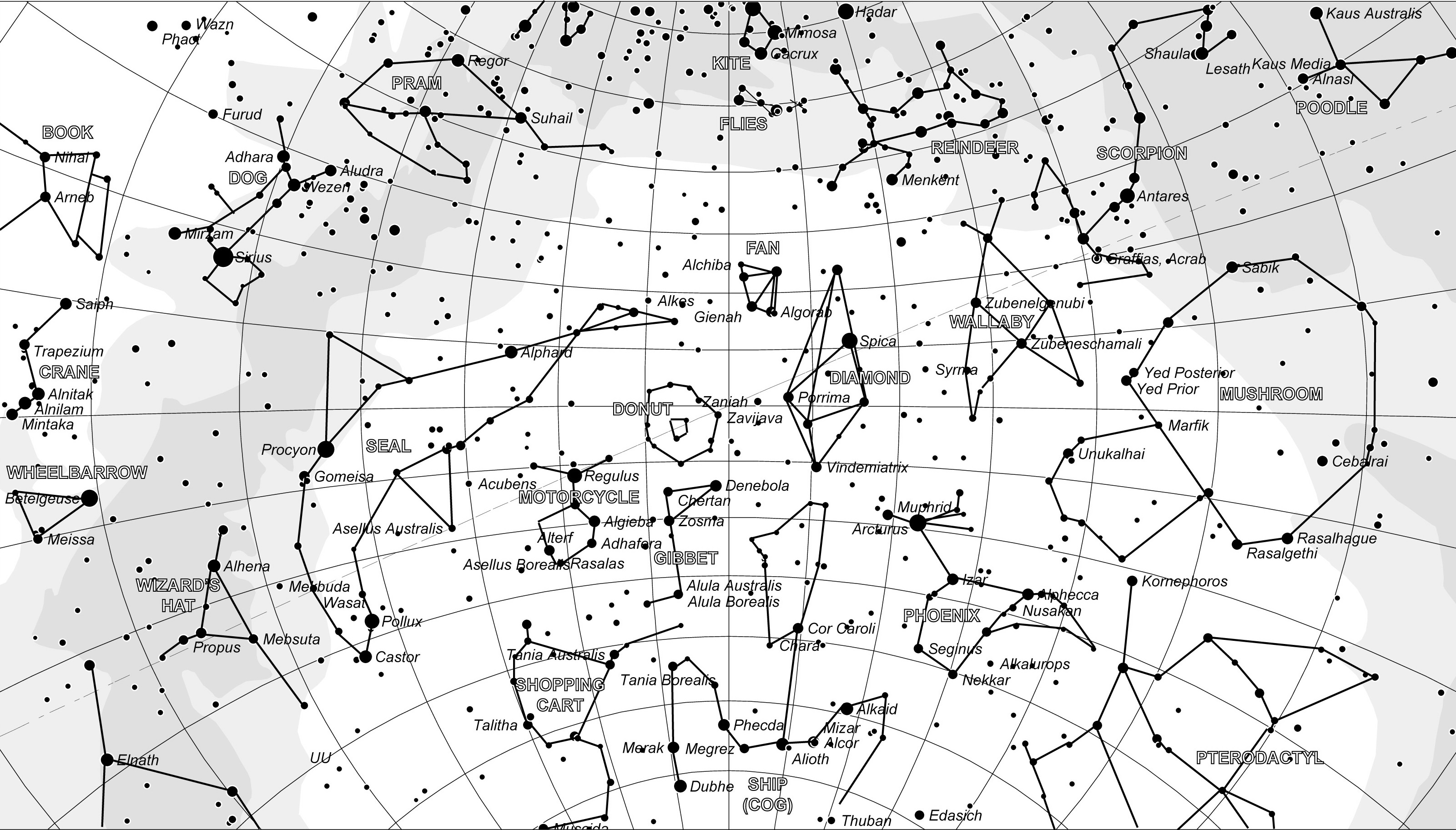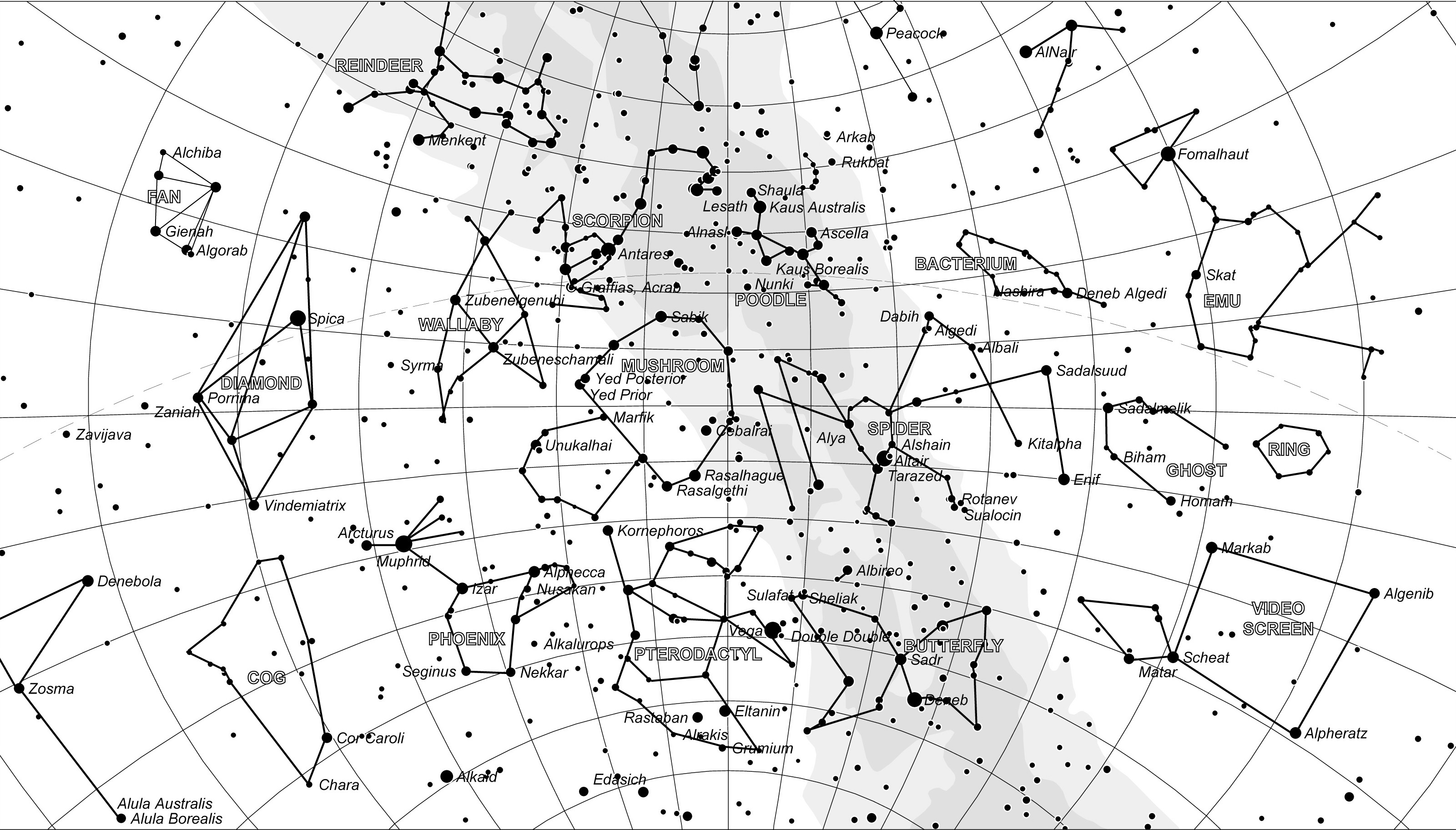
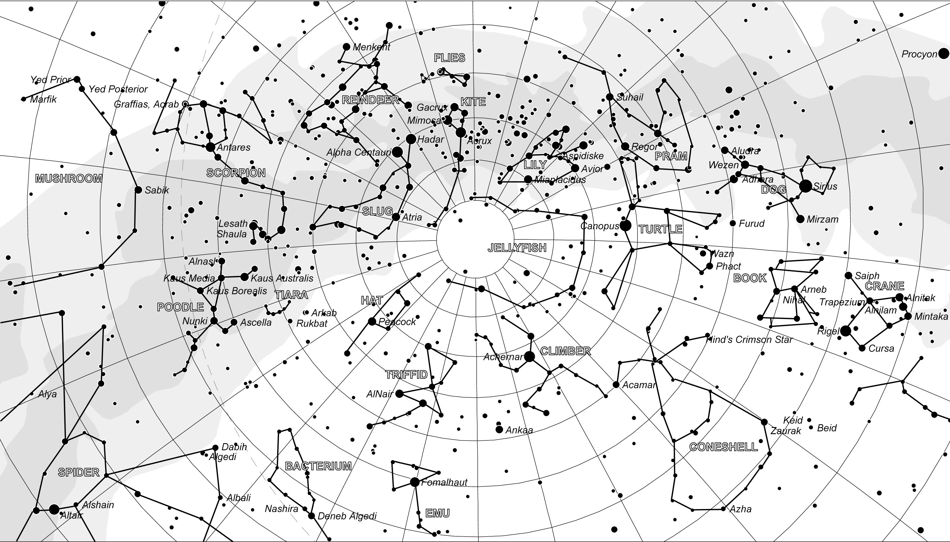
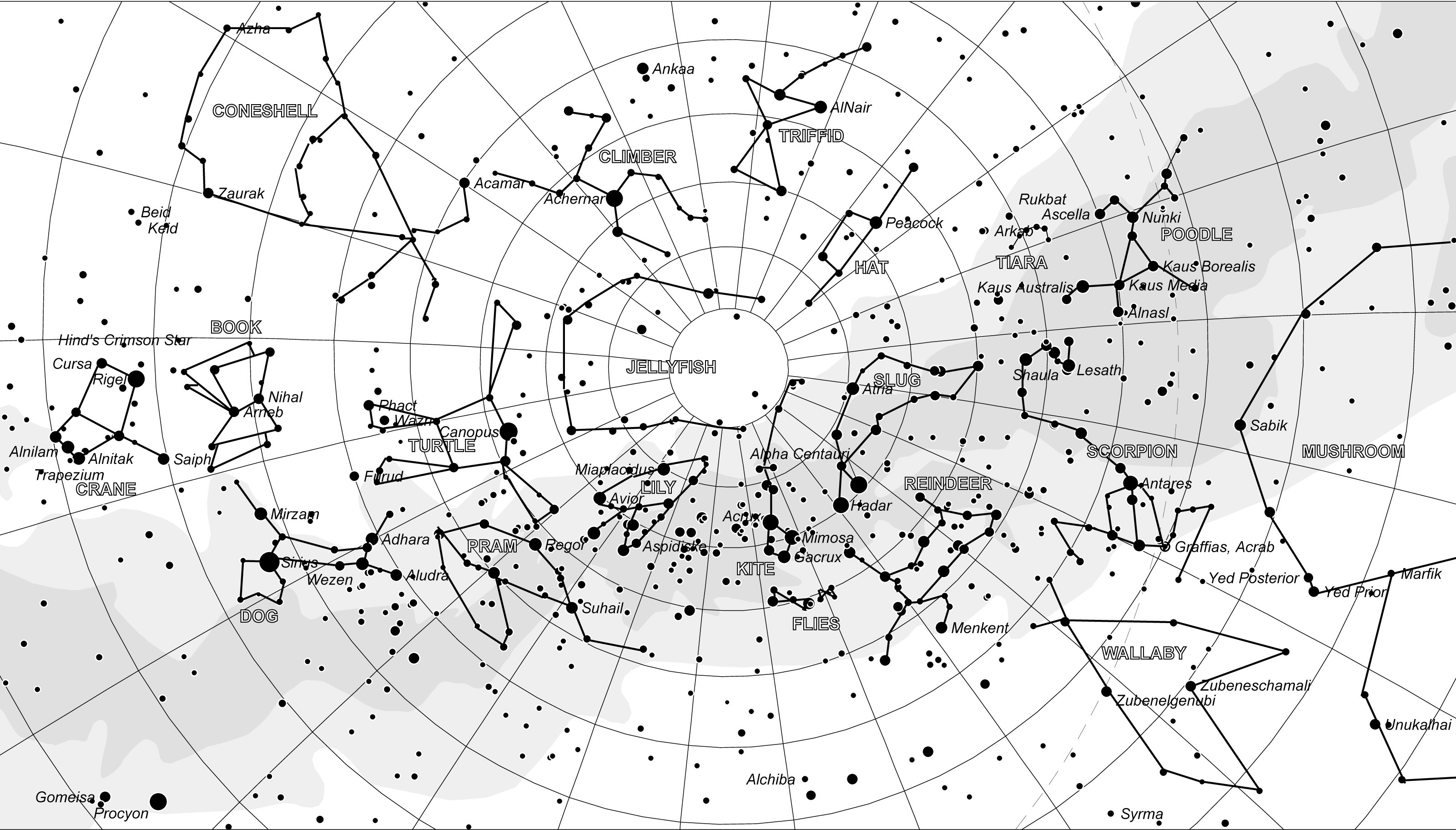
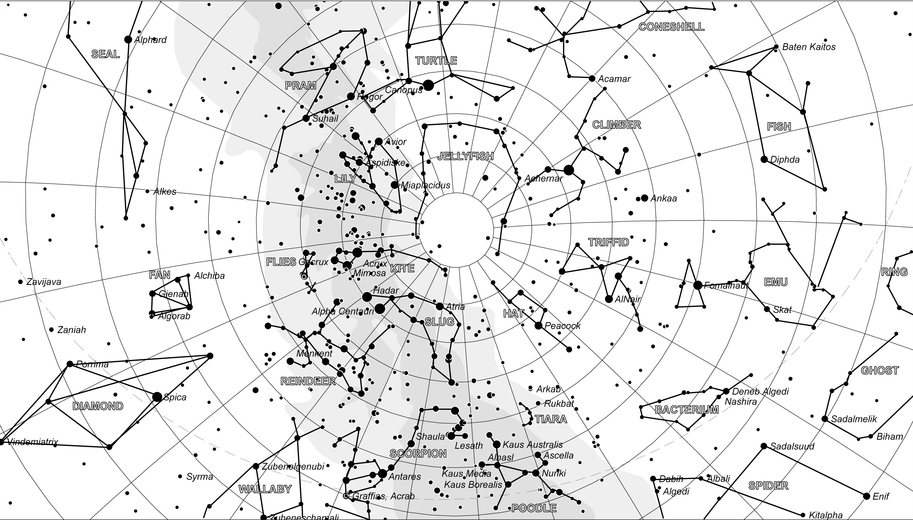
Here are the star maps of the sky, as seen from a location of latitude approx 35° south. They can happily be used by observers at other southern latitudes as well, although they will become less useful as you approach the equator.
I have split the diurnal cycle into 6 hour chunks which is enough, I believe, to convey the essential cartographic information. If you want greater precision in terrestrial latitude and time zone you can use a suitable astronomical app to generate your own custom charts. You will, of course, have to connect the dots manually like I did...
These maps are high resolution. Click on the image to get the full picture.
All these maps and ideas are copyright but you can happily use them for free unless you intend to make money from them, in which case I will be wanting a cut. Email me for permission to use them commercially.
This is what you can expect to see looking south. You can see more above the map if you crane your head over backwards but it would be simpler and more comfortable to just turn around and look northward.
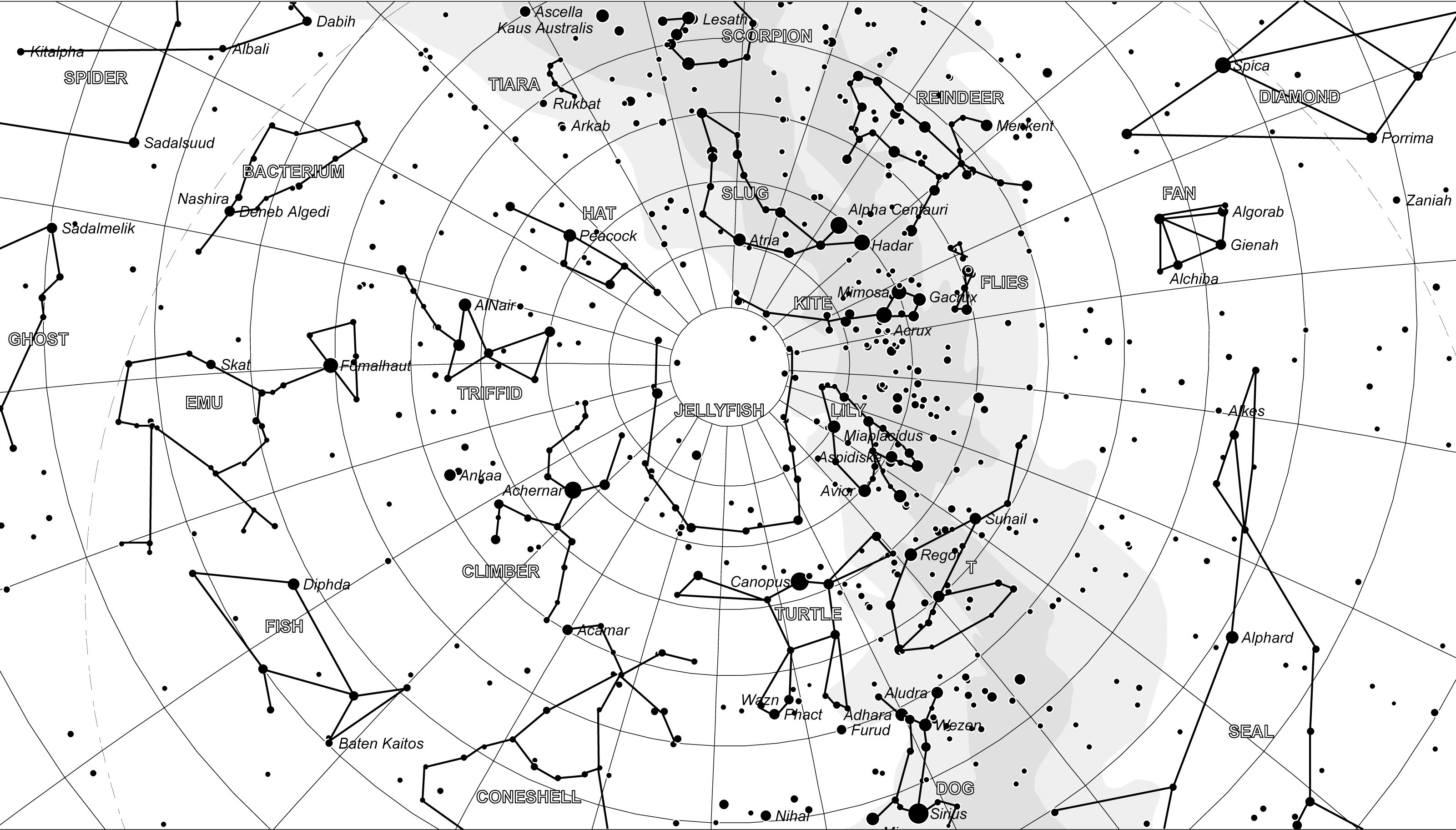
This is what you can expect to see when looking north. You will not be able to see the most northerly constellations as the Earth will get in your way, not to mention trees, buildings, mountains etc...
Not all the constellations will be visible every night. Constellations near the Celestial Equator move with the seasons and those that are in the zenith at midnight in the Summer will be at the zenith at noon in the Winter making them invisible for several months every year and vice-versa.
Also, on a given day, some constellations will be visible at a convenient time, like 10pm, whilst others will only be visible when you prefer to be in bed, like 3am. The dedicated astronomer has to endure cold nights and broken sleep in order to find the gold.